Week 14
A Review of The Negro Travelers’ Green Book “Assured Protection for the Negro Traveler.” Mapping the 1956 edition of the travel guide for African Americans. http://library.sc.edu/digital/collections/greenbookmap.html
Background
The Negro Travelers’ Green Book was a travel guide published from 1936 to 1964 by Victor H. Green. The series, which promised “Assured Protection for the Negro Traveler,” was designed to provide African American travelers and tourists with information that would help them find lodging and dining and be able to sightsee comfortably and safely during the Jim Crow era into the Civil Rights period.
The Spring 1956 guide (the twentieth-anniversary edition) that is featured in the digital humanities project includes over 1700 hotels, tourist homes, restaurants, and other businesses.
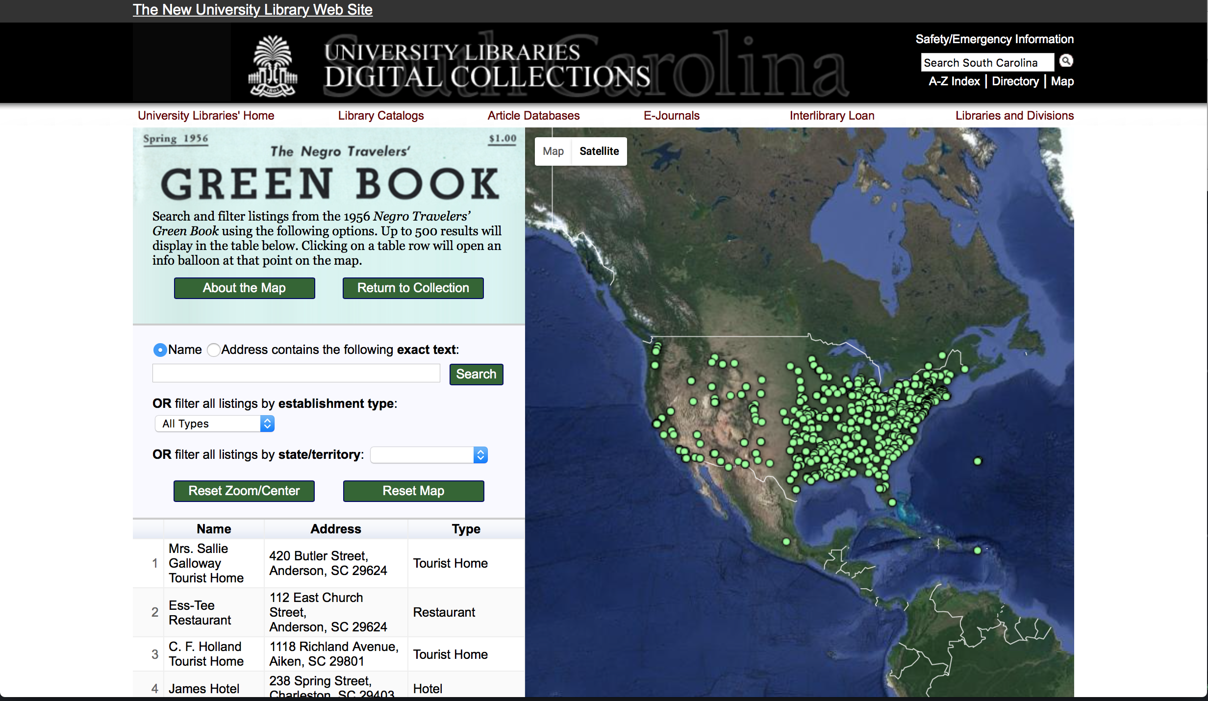
The Green Book site is a joint project between the SC Digital Academy and the Digital Collections and African American Studies departments of the University of South Carolina. Connie Geer led the project, and Matthew W. Shepherd developed the map. In June 2011, Shepherd created a customized Google Map and geocoded listings from the Green Book. He exported the Google Map as a KML file and uploaded it as a spreadsheet to Google Fusion Tables. He then coded and developed the interactive map and Web pages in Adobe Dreamweaver using Google Maps, Fusion Tables, and Visualization Javascript APIs.
In addition to the custom Google Map, a larger interactive map with search options is featured. The data points on the map are taken from listings in the Green Book that could be located to within approximately a half-mile radius. Some listings are represented approximately or omitted because of discrepancies between the listings and the current map data from Google Maps. Errors and discrepancies in the original text are indicated by corrections and notes in square brackets. Road names that have changed since 1956 (such as streets now named for Dr. Martin Luther King, Jr.) are listed with the current name added in square brackets.
A scan of the Green Book can also be viewed and searched as a digital object that contains all of the listings including those that do not appear on the map.
Review
From a design standpoint, the site is visually appealing albeit simple, and the navigation and other functions work smoothly.
Plotting the places on the map is a logical approach given that the Green Book was a traveler’s guide. The map helps users visualize the locations. That said, the project is mostly just a map. It needs more supporting writings and scholarship around it to better set the context and provide interpretation that would help visitors to the site grasp the bigger picture of the guide’s place in history. It would also help to have writings that address how the original audience for the guide used and reacted to it. Such writings could provide more of the human emotional impact and connection to history than what the map alone offers.
It is nice that the description of the site includes some of the technical details of how the Guide was scanned and the project constructed. In my classes on digitizing cultural heritage materials, the instructor has stressed the need for providing technical details both for the purpose of disseminating best digitization practices and to be accountable to users through openness about the transformations and remediations that take place in moving paper originals to the web.
It is also nice that the About page mentions that data correction occurred, but it could be enhanced with specific examples and explanation of how the decisions about corrections were made. Another enhancement to the site would be the option to download and reuse the map data. (The scanned pages can, however, be downloaded.)
Finally, it is unclear if the site is actively being maintained. There is a note that “At present, the Green Book map is still undergoing development,” but no date or change history is given.